The bay
The Bay of Kotor and UNESCO
Why the Bay of Kotor is a World Heritage area: its length, its narrow strait, Kotor's walls, the islets and the sailors' history, with sources and no prices.
Choose your boat date ↗Quick answer
The Bay of Kotor is a winding inlet of the Adriatic in southwestern Montenegro, about 28 kilometres long. The Natural and Culturo-Historical Region of Kotor, which covers the old town, the fortifications and the inner bay, was inscribed as a World Heritage Site in 1979. Both islets near Perast are part of it, so the boat tour passes through a protected landscape.
What the bay is
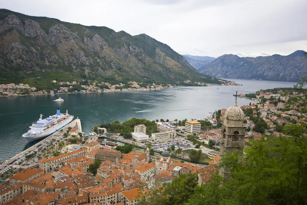
Wikipedia calls the Bay of Kotor a winding bay of the Adriatic Sea and the region around it, also known locally as the Boka. It is about 28 kilometres long, and several smaller bays are linked by narrower channels. Two massifs of the Dinaric Alps frame it: Orjen to the west and Lovćen to the east. That is why the water seems to sit at the foot of the mountains, and why boats see so much cliff and so little open horizon.
A river that became a bay
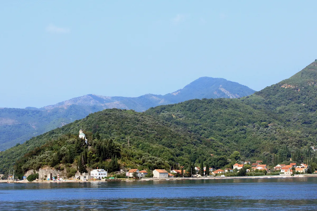
Wikipedia says the bay is a ria, the flooded valley of a vanished river, and that tectonic movement and karst processes broke the river system apart. The narrowest part is the Verige Strait, about 2,300 metres long and only about 340 metres wide at its narrowest point. It separates the inner bay from the Bay of Tivat. Boats on the Blue Cave route pass through this region on the way to the bay's mouth.
What UNESCO protects
The World Heritage site covers the old town of Kotor, the fortifications of Kotor and the surrounding region of the inner bay, past the Verige Strait. Wikipedia names Risan and Perast among the towns, and adds that the islets of St George and Our Lady of the Rocks are part of the site. It was inscribed in 1979, the year of an earthquake that damaged Kotor, and was taken off the danger list in 2003.
Kotor's walls
Wikipedia describes the fortifications as a system of walls, gates, bastions and ramparts that climb the mountain of St John, to a castle high above the town. Most of the structures were built under Venetian rule, with later changes by the Austrians. The fortifications climb more than 260 metres above sea level. Inside the walls, the Cathedral of Saint Tryphon is among the notable buildings, built in 1166 according to the same article.
A sailors' bay
The bay has a long maritime tradition. Wikipedia says its fleet peaked at around 300 ships in the 18th century, when the Boka was a rival to Dubrovnik and Venice, and that Kotor had a naval academy called the Scuola Nautica. In the Austro-Hungarian period, the bay supplied most of the sea captains of the Österreichischer Lloyd shipping company. Perast's church islet, built by seamen, fits that story neatly.
The bay's mouth and its towns
Wikipedia lists the bay's well-preserved medieval towns as Kotor, Risan, Tivat, Perast, Prčanj and Herceg Novi. The outermost part is the Bay of Tivat, and the Bay of Herceg Novi lies on the seaward side, at the main entrance. At that entrance sits Prevlaka, a small peninsula in southern Croatia. The Blue Cave run heads for this mouth, which is why it feels more like the open sea than the sheltered water around Perast.
Venice, Perast and a flag
Perast owed its rise to Venice. Wikipedia says it had free trade with the Republic of Venice and that, after a Turkish siege in 1654, it gained the right to guard the Venetian flag of St Mark. When Napoleon defeated the Republic of Venice in 1797, Perast stayed loyal for several months before lowering the flag, and the town's decline began. Many of the baroque buildings seen from the boat date from the prosperous period.
Two faiths, one shoreline
The bay's people, called Bokelji, are mostly Eastern Orthodox, with a Catholic minority, and Wikipedia says Catholicism was the dominant faith in Perast. That mix shows in the buildings: Catholic and Orthodox churches and monasteries line the shore, such as the Savina monastery near Herceg Novi and the Benedictine monastery on an island opposite Perast. The church islet is Catholic, so its dress rule is a church's rule, not a tourist-boat rule.
Weather and the water
Wikipedia says the bay lies in a Mediterranean climate zone but is one of the wettest places in Europe, because of its mountains. The Bora, a cold downslope wind, appears in winter, and the jugo, a warm humid wind, brings heavy rain, mostly in autumn and spring. August is frequently dry. For a boat trip this matters: wind and swell on the open water, more than rain, are what change a route.
Frequently asked questions
How long is the Bay of Kotor?
About 28 kilometres, with a shoreline of around 107 kilometres, according to Wikipedia. It is made of several smaller bays joined by narrower channels.
When did UNESCO list the bay?
The Natural and Culturo-Historical Region of Kotor was inscribed in 1979. It was taken off the danger list in 2003.
Are the islets near Perast protected?
Yes. Wikipedia says the islets of St George and Our Lady of the Rocks are part of the World Heritage site.
What is the Verige Strait?
The narrowest section of the bay, about 2,300 metres long and about 340 metres wide at its narrowest point. It separates the inner bay from the Bay of Tivat.
Sources